The 2:15am alarm went off far too soon. I attempted to snooze for a few minutes and deny the fact that I had to get up, but before long my fellow bunkmates, mountaineers from a dozen different countries, began to rise and get ready for the voyage ahead. I packed up my things and headed to the main hall of the mountain hut, bleary eyed and dreading the climb ahead. I took prophylactic ibuprofen and diamox to stave off the altitude sickness and ate a small snack of popcorn and biscuits, the most anyone could reasonably stomach at such an ungodly hour. Soon Sam and Phillip appeared, we organized our things, and then set off into the pitch black beyond Shipton's camp.
 |
| Climbing in the pitch black |
The stars wheeled overhead, and we were surrounded by the shadowy forms of the giant groundsels, whose massive green leaves would sometimes be illuminated by my headlamp. Soon we started to climb the steep ascent to Lenana, the "easiest" of Mt. Kenya's 3 peaks at "only" 16,355 ft. The way was difficult, incredibly steep and with much scree. Phillip offered a lot of motivating words, encouraging me to take things one step at a time, and this advice turned out to be essential to making it up the mountain. Slowly the large groundsels vanished, and only tiny weeds were left for vegetation, then only fuzzy lichen eking out a living in the rare mountain air. For 2 and a half hours we crawled up the gravelly slope in the inky darkness, with no sign of our destination, or of the coming of dawn. We had now climbed so high we could see over the valley walls to see the glittering lights of the cities surrounding Mt. Kenya, a hundred miles away. Eventually we reached a sort of flat area with rocks. I thought that was the peak, but the same pointed up at a sheer rock face above us: that was the peak, we still had another 400 feet to go. It seemed like an impossible task.
 |
| Dawn |
 |
| Morning light |
I actually had something like a mini panic attack when I realized how much further we had to go. I was convinced that my legs were going to give out on the way back down and I'd plummet off the side of the mountain to my death. To make matters worse, the incline was even steeper on this part of the mountain, and the gravel was more treacherous. All the same, I managed to keep a clear head and we ascended higher onto the mountain. Pink ribbons of light in the east signaled the coming dawn, and I could finally see the behemoth of a mountain that I was climbing up. Just before reaching the summit, we encountered snow caps, the crown on Ngai's creation; we were approaching the home of a god.
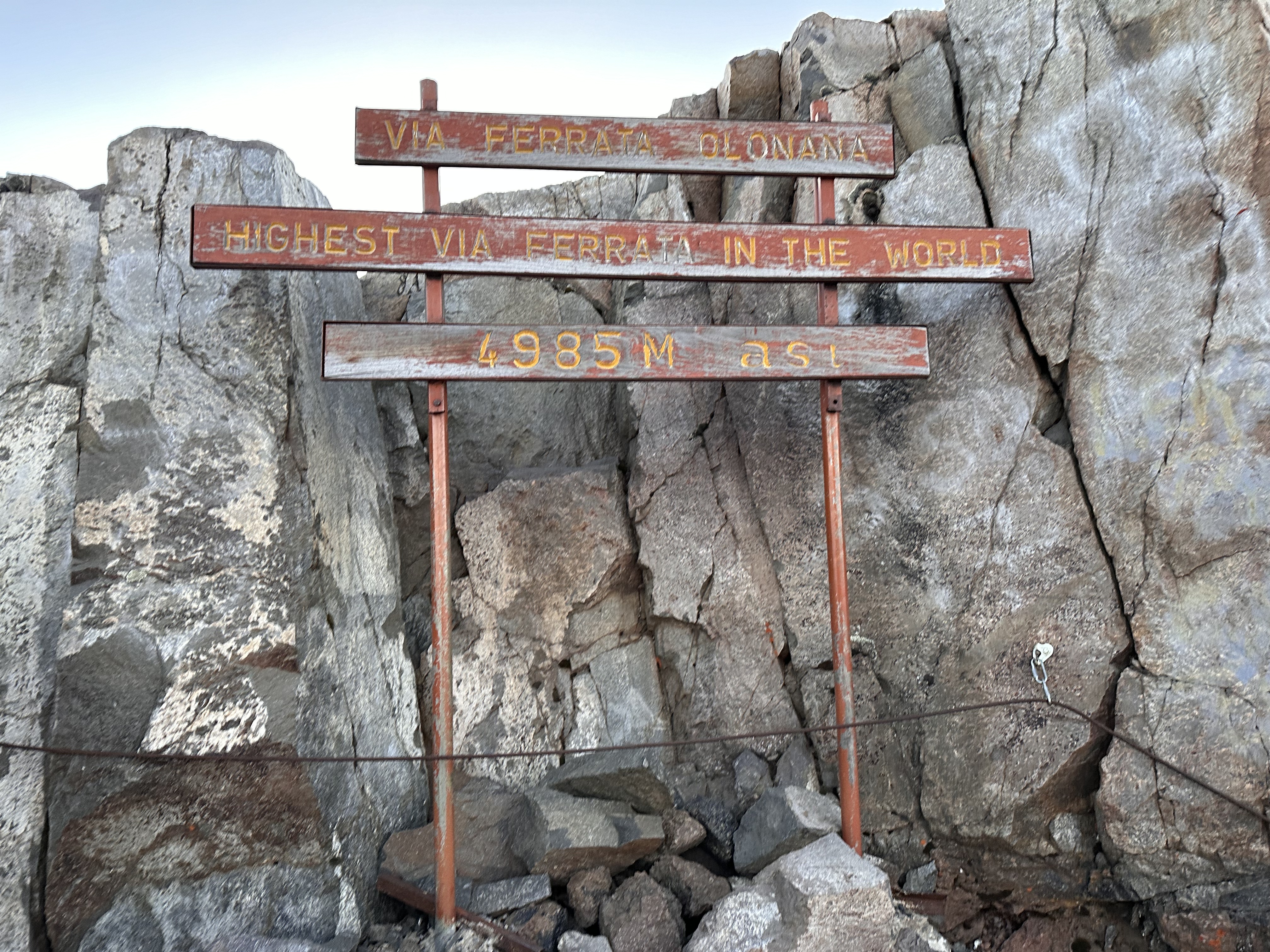
We rounded the corner and were met by the sight of a small round glacier below, and a view of Batian, Mt. Kenya's tallest peak: an intimidating spire of volcanic rock towering beside us. A metal rope helped us ascend the last few dozen feet: the world's tallest via ferrata! There were a small group of people at the top of the summit, laughing and cheering in the now bright morning sun. Sam, Phillip and I soon joined them. We took our obligatory photos and took in the view of the immense landscape around us.
 |
| World's highest via ferrata |
 |
| Looking towards Batian |
 |
| Sunrise |
 |
| Moonscape |
 |
| Success |
The way down was precipitous, and we all slipped more than a few times. The view was spectacular in the morning light: we could see everything for hundreds of miles. Eventually we reached a small flat rocky area next to a tarn where we recuperated, had a snack, and let the relief of finally having conquered the mountain set in. Our next step was to rendezvous with Rochelle, Natalya, and the other guides for brunch.
 |
| Looking down the mountain |
 |
| Carefully descending |
 |
| Looking back at the peak |
 |
| Mars-scape |
 |
| Tarn |
We steadily made our way down the rocky cliffs until we reached the brunch spot where I promptly found a comfy rock and took a nap. I awoke shortly as Rochelle, Natalya, and the others arrived. We ate our brunch heartily, but Rose, Sam's daughter who had come along as a porter, had come down with a bad case of altitude sickness and was not able to eat or drink anything. She would have to descend the mountain with us, that was the only way her altitude sickness would go away.
 |
| High alpine views |
 |
| Descending to the brunch spot |
 |
| Mountain lake |
 |
| Brunch spot |
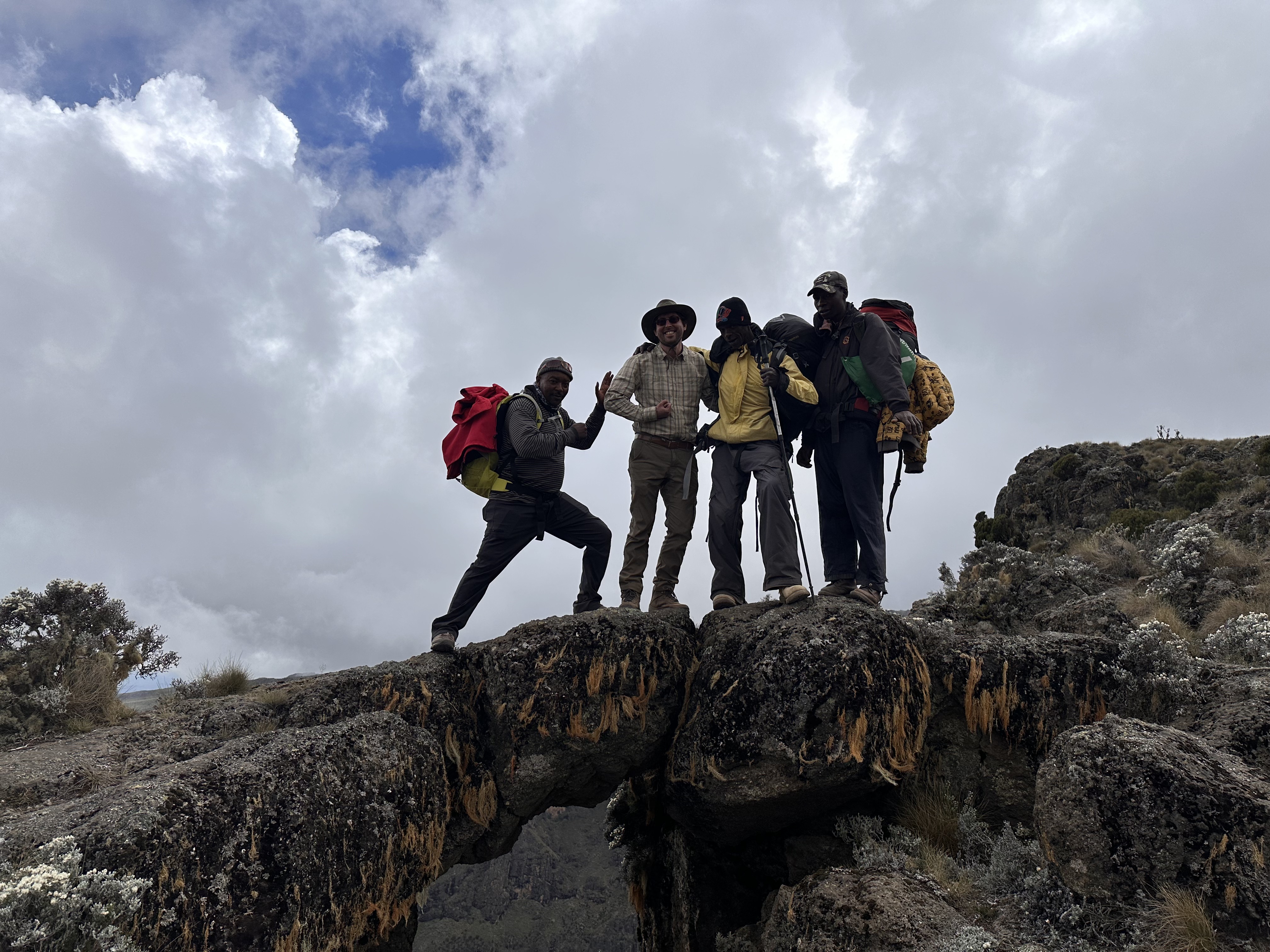
After some time, we once again packed up and began our respective journeys: Phillip and I would go to Chogoria, and Rochelle and Natalya would keep climbing up to Nelion. We bid our farewells and good lucks and continued trekking down the mountain. We passed back through the forests of giant groundsels, and through some lush meadows with trickling streams. we passed by other porters and campers on their way up the mountain. Periodically Rose needed to stop to rest due to her symptoms, and I gave her some tums and ibuprofen periodically to make it easier for her to keep hiking.
 |
| Descending back to Groundsel-ville |
After weaving up and down several valleys on a large plateau we turned west and descended into a cirque, and old glacially carved bowl shaped valley that has now turned into a muddy bog. This cirque where a glacier once stood plunged down into an immense V-shaped valley with sheer rock cliffs hundreds of feet tall. Alfred, our assistant guide, noted that this was the "Gorges Valley". We continued hiking until we descended back down into the Chaparral. At this point our oxygen levels were replenished and our energy levels were improving. we were walking down a very very long ridge of the mountain and in the distance we could see vast green rolling hills, valleys, and the peaks of other dormant volcanoes. I had gotten to chatting with Alfred the guide about Kikuyu culture and life in Kenya. He pointed to a tiny white speck in the distance and stated that this was our destination. After nearly 12 hours of hiking already this was not welcome news...
 |
| Misty valley |
 |
| Hooray! |
 |
| Gorges Valley |
 |
| Cliff walls |
 |
| our destination: that white speck |
 |
| Vast open country |
 |
| Tranquil stream |
we continued trekking through the Chaparral and periodically peering into the Gorges valley, which was unbelievably spectacular with its lake, waterfall, river, and sheer cliffs. eventually we reached the bottom of the crossed a large, crystal clear river which must have it's source in Mt. Kenya. we rested a bit by the river campsite and had a small lunch of potatoes and noodles. Phillip then informed me that is was only 7 km to our destination (only!). We walked along a wide dirt road through rolling hill country filled with small birds darting about. Phillip was getting nervous as it was getting near dark, and animals would be stirring soon. Luckily, a pickup truck came along and offered us a ride to our destination. We shortly arrived at Ambas lodges, a set of cabins just inside the national park boundary. We could finally wash off the crust of several days of backpacking and put our feet up by the fire. It was good to be back in civilization. Phillip and I both collapsed early that night, but not before listening to the eerie barks of hyenas outside the cabin.
 |
| Finally at the lodge |


No comments:
Post a Comment